
Mappa topografica Champa
Clicca sulla mappa per visualizzare l'altitudine.
Champa
Champa has an average elevation of 253 metres (830 feet). It is located on the banks of Hasdeo river, a tributary of Mahanadi.
A proposito di questa mappa
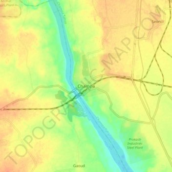
Nome: Mappa topografica Champa, altitudine, rilievo.
Altitudine media: 254 m
Altitudine minima: 231 m
Altitudine massima: 270 m