
Mappa topografica Mississippi River
Mappa interattiva
Clicca sulla mappa per visualizzare l'altitudine.
A proposito di questa mappa
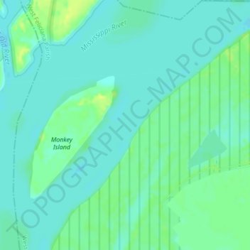
Nome: Mappa topografica Mississippi River, altitudine, rilievo.
Altitudine media: 13 m
Altitudine minima: 7 m
Altitudine massima: 24 m
The uppermost lock and dam on the Upper Mississippi River is the Upper St. Anthony Falls Lock and Dam in Minneapolis. Above the dam, the river's elevation is 799 feet (244 m). Below the dam, the river's elevation is 750 feet (230 m). This 49-foot (15 m) drop is the largest of all the Mississippi River locks and dams. The origin of the dramatic drop is a waterfall preserved adjacent to the lock under an apron of concrete. Saint Anthony Falls is the only true waterfall on the entire Mississippi River. The water elevation continues to drop steeply as it passes through the gorge carved by the waterfall.
Altre mappe topografiche
Clicca su una mappa per visualizzarne la topografia, l'altitudine e il rilievo.
Tunica Hills
United States > Louisiana > West Feliciana Parish
Tunica Hills, West Feliciana Parish, Louisiana, 70782, United States
Altitudine media: 53 m
St. Francisville
United States > Louisiana > West Feliciana Parish
St. Francisville, West Feliciana Parish, Louisiana, United States
Altitudine media: 39 m