
Mappa topografica Mohali
Clicca sulla mappa per visualizzare l'altitudine.
A proposito di questa mappa
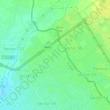
Nome: Mappa topografica Mohali, altitudine, rilievo.
Altitudine media: 326 m
Altitudine minima: 317 m
Altitudine massima: 336 m
Altre mappe topografiche
Clicca su una mappa per visualizzarne la topografia, l'altitudine e il rilievo.
Ludhiana District
The topography of the district is a typical representative of an alluvial plain. It owes its origin to the aggravation work of the Satluj River. The alluvium deposited by the river has been worked over by the wind, which gave rise to a number of small dunes and sand mounds. Most of these dunes have been…
Altitudine media: 246 m
Patiala
India > Punjab > Patiala Tahsil
Patiala is located at 30°19′N 76°24′E / 30.32°N 76.40°E / 30.32; 76.40. It has an average elevation of 250 metres (820 feet). During the short existence of PEPSU, Patiala served as its capital city.
Altitudine media: 255 m
Patiala
India > Punjab > Patiala Tahsil
Patiala is located at 30°19′N 76°24′E / 30.32°N 76.40°E / 30.32; 76.40. It has an average elevation of 250 metres (820 feet). During the short existence of PEPSU, Patiala served as its capital city.
Altitudine media: 255 m