
Mappa topografica Gilgit
Clicca sulla mappa per visualizzare l'altitudine.
Gilgit
Gilgit lacks significant rainfall, averaging in 120 to 240 mm (4.7 to 9.4 in) annually, as monsoon breaks against the southern range of Himalayas. Irrigation for land cultivation is obtained from the rivers, abundant with melting snow water from higher altitudes.
A proposito di questa mappa
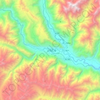
Nome: Mappa topografica Gilgit, altitudine, rilievo.
Altitudine media: 3’002 m
Altitudine minima: 1’340 m
Altitudine massima: 5’626 m
Altre mappe topografiche
Clicca su una mappa per visualizzarne la topografia, l'altitudine e il rilievo.