

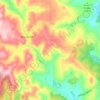
Mappa topografica Jenner
Clicca sulla mappa per visualizzare l'altitudine.
A proposito di questa mappa

Nome: Mappa topografica Jenner, altitudine, rilievo.
Luogo: Jenner, Sonoma County, California, United States (38.42964 -123.13556 38.46964 -123.09556)
Altitudine media: 89 m
Altitudine minima: -2 m
Altitudine massima: 354 m
Altre mappe topografiche
Clicca su una mappa per visualizzarne la topografia, l'altitudine e il rilievo.


Sea Ranch
United States > California > Sonoma County > Sea Ranch
The Sea Ranch has distinctive architecture consisting of simple timber-frame structures clad in wooden siding or shingles. The building typology of the Sea Ranch draws on the local agricultural buildings for inspiration, in the way that those buildings are designed to deal with prevailing weather and…
Altitudine media: 104 m


Sebastopol
United States > California > Sonoma County
Sebastopol's elevation is 65 to 250 feet (20 to 76 meters) above sea level. Its downtown is at the intersection of State Route 12 and State Route 116 (Gravenstein Highway), approximately 9 mi (14 km) west of U.S. Route 101.
Altitudine media: 44 m




Sebastopol
United States > California > Sonoma County
Sebastopol's elevation is 65 to 250 feet (20 to 76 meters) above sea level. Its downtown is at the intersection of State Route 12 and State Route 116 (Gravenstein Highway), approximately 9 mi (14 km) west of U.S. Route 101.
Altitudine media: 69 m




Bouverie Wildflower Preserve
United States > California > Sonoma County > Glen Ellen
Altitudine media: 135 m
