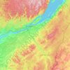
Mappa topografica Lac Clair
Clicca sulla mappa per visualizzare l'altitudine.
A proposito di questa mappa

Nome: Mappa topografica Lac Clair, altitudine, rilievo.
Altitudine media: 338 m
Altitudine minima: 305 m
Altitudine massima: 396 m
Altre mappe topografiche
Clicca su una mappa per visualizzarne la topografia, l'altitudine e il rilievo.
Quebec
Canada > Quebec > Urban agglomeration of Québec
Quebec City was built on the north bank of the Saint Lawrence River, where it narrows and meets the mouth of the Saint-Charles River. Old Quebec is located on top and at the foot of Cap-Diamant, which is on the eastern edge of a plateau called the promontory of Quebec (Quebec hill). Because of this topographic…
Altitudine media: 117 m
Gatineau
Gatineau is located in southwestern Quebec, on the northern bank of the Gatineau River. It is situated at an elevation of around 50 m (164.042 ft) The Gatineau Hills are the foothills of the Laurentian Mountains and located in the region. It is also the location of the second largest urban park in the world.…
Altitudine media: 127 m
Rimouski
Canada > Quebec > Rimouski-Neigette
The tide station located at Pointe-au-Père serves as the reference point for measuring mean sea level for the North American Vertical Datum of 1988, which is the reference point for determining altitude in North America.
Altitudine media: 126 m
Mont-Tremblant
Canada > Quebec > Les Laurentides
The city is dominated by Mont Tremblant with an altitude of 968m which is one of the highest peaks in southern Quebec.
Altitudine media: 358 m
Pierrefonds-Roxboro
Canada > Quebec > Urban agglomeration of Montreal > Montreal
Altitudine media: 30 m

Mont Saint-Bruno
Canada > Quebec > Urban agglomeration of Longueuil > Saint-Bruno-de-Montarville
Altitudine media: 85 m
Mount Royal
Canada > Quebec > Urban agglomeration of Montreal > Montreal
The hill is part of the Monteregian Hills situated between the Laurentians and the Appalachian Mountains. It gave its Latin name, Mons Regius, to the Monteregian chain. The hill consists of three peaks: Colline de la Croix (or Mont Royal proper) at 233 m (764 ft), Colline d'Outremont (or Mount Murray, in the…
Altitudine media: 111 m


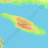
Anticosti Island
Topographically, Anticosti Island can be divided into three distinct regions: two lowland areas, rarely exceeding 150 metres (490 ft) in elevation, in the eastern and western thirds of the island linked along the coast; and a central highland forming a plateau that rises to just over 300 m (980 ft). This…
Altitudine media: 30 m

Schefferville
Canada > Quebec > Caniapiscau (MRC)
The cold winters are caused in part by elevation, and in part the ice cover of Hudson Bay eliminating maritime moderation in winter. Although Schefferville is nearer the Atlantic, the cold Labrador Current brings cold air also from the east. In summer, the Hudson Bay water is cold after just thawing, and the…
Altitudine media: 537 m














Lanaudière
The region of Lanaudière is part of central Quebec and is located between the Saint Lawrence River and the Laurentian Mountains, between Mauricie and the Laurentides. Lanaudière attracts a good deal of interest from vacationers due to its unique character founded largely on the harmony between its culture…
Altitudine media: 332 m


Montmagny (MRC)
Its territory can be divided into three main geographical areas. The first is constituted of the estuary of the Saint Lawrence River and its islands. Second are the plains, which includes the Saint Lawrence Lowlands, which run from east to west and covers the northern portion of the Montmagny RCM, and is…
Altitudine media: 311 m








Bas-Saint-Laurent
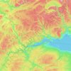
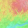
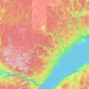
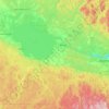
The topography of Bas-Saint-Laurent has two main elements : the plateaus of the Appalachian Mountains, called Notre Dame Mountains, and the lowlands in the fine stripe of land along the Saint Lawrence river. These are separated by an intermediate area of ridges and foothills which meld with the plateaus. The…
Altitudine media: 285 m