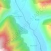
Mappa topografica Sickle Moon
Clicca sulla mappa per visualizzare l'altitudine.
Sickle Moon
The east part of Kishtwar sub-range was first assessed by an Australian team in 1939. The eastern approaches of this Peak were explored by two Austrian mountaineers in 1947, including Fritz Kolb, from its base at Machail and climbed two small peeks. After a period of closure, the area was again open to non-Indians in the early seventies, and there was a rush to climb the obvious plums in the western region. In 1973 British mountaineers Nick Escourt and Chris Bonington made an ascent of Brammah I (6416 m) and two years later in 1975 a team of Indian High Altitude Warfare School (HAWS) led by Lt. Col. D. N. Tankha made the first ascent of this Peak.
A proposito di questa mappa

Nome: Mappa topografica Sickle Moon, altitudine, rilievo.
Luogo: Sickle Moon, Marwah, Kishtwar, Jammu and Kashmir, India (33.60689 76.13056 33.60699 76.13066)
Altitudine media: 5’549 m
Altitudine minima: 4’497 m
Altitudine massima: 6’500 m
Altre mappe topografiche
Clicca su una mappa per visualizzarne la topografia, l'altitudine e il rilievo.