
Mappa topografica Semmes
Mappa interattiva
Clicca sulla mappa per visualizzare l'altitudine.
A proposito di questa mappa
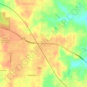
Nome: Mappa topografica Semmes, altitudine, rilievo.
Luogo: Semmes, Mobile County, Alabama, 36575, United States (30.75869 -88.27884 30.79869 -88.23884)
Altitudine media: 68 m
Altitudine minima: 40 m
Altitudine massima: 82 m
Semmes is located at 30.778N, -88.259W. Elevation is 256 feet. The Semmes area is bounded to the North by the Citronelle area, bounded to the East by the cities of Saraland and Prichard, bounded to the South by the city of Mobile, and finally bounded to the West by Big Creek Lake.