
Mappa topografica Princetown
Mappa interattiva
Clicca sulla mappa per visualizzare l'altitudine.
A proposito di questa mappa
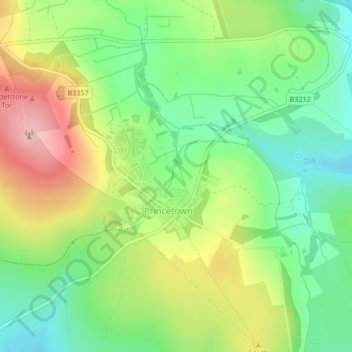
Nome: Mappa topografica Princetown, altitudine, rilievo.
Altitudine media: 415 m
Altitudine minima: 347 m
Altitudine massima: 513 m
Princetown, like the rest of Dartmoor, experiences colder and wetter weather than most of Devon, especially because of its high altitude. Snow is uncommon but is usually heavy when it does fall. According to the Köppen climate classification the climate would be classified as Cfb bordering on Cfc.
Altre mappe topografiche
Clicca su una mappa per visualizzarne la topografia, l'altitudine e il rilievo.
Tavistock
United Kingdom > England > Devon > West Devon
Tavistock, West Devon, Devon, England, United Kingdom
Altitudine media: 139 m
Chagford
United Kingdom > England > Devon > West Devon
Chagford, West Devon, Devon, England, United Kingdom
Altitudine media: 309 m