

Mappa topografica Amlai
Clicca sulla mappa per visualizzare l'altitudine.
A proposito di questa mappa
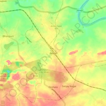
Nome: Mappa topografica Amlai, altitudine, rilievo.
Luogo: Amlai, Madhya Pradesh, 484116, India (23.13327 81.55173 23.21327 81.63173)
Altitudine media: 485 m
Altitudine minima: 436 m
Altitudine massima: 529 m
Altre mappe topografiche
Clicca su una mappa per visualizzarne la topografia, l'altitudine e il rilievo.

Jabalpur District
The district is part of Jabalpur Division. It has an average elevation of 411 metres (1348 ft).
Altitudine media: 460 m


Narmada Udgam Kund
India > Madhya Pradesh > Pushparajgarh Tehsil > Amarkantak
Altitudine media: 1’043 m


Shajapur
The region stretches from north to south in the middle of the district covering considerable portions of Agar Malwa and Shajapur tehsils and a small part of Susner tehsil. It is a part of the Malwa plateau with typical topography. There is a continuous chain of hills throughout the entire region. The height of…
Altitudine media: 466 m


Bandhavgarh National Park/Tiger Reserve
India > Madhya Pradesh > Manpur Tahsil
Altitudine media: 443 m


