
Fai una donazione
Equipaggiati per la tua prossima avventura:
In qualità di Affiliato Amazon, questo sito riceve una commissione sugli acquisti idonei, senza costi aggiuntivi per l’utente.
Mappa topografica Behchokǫ̀
Clicca sulla mappa per visualizzare l'altitudine.
Fai una donazione
Equipaggiati per la tua prossima avventura:
In qualità di Affiliato Amazon, questo sito riceve una commissione sugli acquisti idonei, senza costi aggiuntivi per l’utente.
Behchokǫ̀
As the community grew alongside increased services such as a mission-run hospital and church, the government viewed the topography of Fort Rae as unsuitable for expansion. In the 1950s there was concern about runoff from animal and human wastes contaminating sources of drinking water, and the government proposed constructing a new settlement on more favourable terrain. The community became known as Edzo and was located on the west side of the Frank Channel opposite Fort Rae a 24 km (15 mi) drive away. Most of the Dene families refused to move from their community so that Rae (62°49′43″N 116°03′08″W / 62.82861°N 116.05222°W / 62.82861; -116.05222 (Rae)) and Edzo (62°46′30″N 116°02′26″W / 62.77500°N 116.04056°W / 62.77500; -116.04056 (Edzo)) (Rae-Edzo) became two separate communities although administered together.
Fai una donazione
Equipaggiati per la tua prossima avventura:
In qualità di Affiliato Amazon, questo sito riceve una commissione sugli acquisti idonei, senza costi aggiuntivi per l’utente.
A proposito di questa mappa
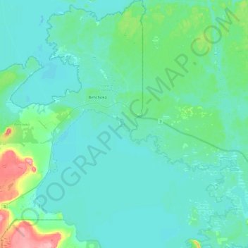
Nome: Mappa topografica Behchokǫ̀, altitudine, rilievo.
Altitudine media: 169 m
Altitudine minima: 152 m
Altitudine massima: 257 m
Fai una donazione
Equipaggiati per la tua prossima avventura:
In qualità di Affiliato Amazon, questo sito riceve una commissione sugli acquisti idonei, senza costi aggiuntivi per l’utente.