

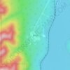
Mappa topografica Yates Natural Area
Clicca sulla mappa per visualizzare l'altitudine.
A proposito di questa mappa

Nome: Mappa topografica Yates Natural Area, altitudine, rilievo.
Altitudine media: 880 m
Altitudine minima: 842 m
Altitudine massima: 905 m
Altre mappe topografiche
Clicca su una mappa per visualizzarne la topografia, l'altitudine e il rilievo.


Whitehorse Wildland Provincial Park
Canada > Alberta > Yellowhead County
The northern part of the park contains the watershed of the Whitehorse Creek and the ridges of foothills forming the valley for the creek. The northern ridge that bounds the Whitehorse Creek valley is the Nikanassin Range while the southern is the Miette Range. Within the park, in the Nikanassin Range are four…
Altitudine media: 1’951 m
