
Fai una donazione
Equipaggiati per la tua prossima avventura:
In qualità di Affiliato Amazon, questo sito riceve una commissione sugli acquisti idonei, senza costi aggiuntivi per l’utente.
Mappa topografica Le Tour
Clicca sulla mappa per visualizzare l'altitudine.
Fai una donazione
Equipaggiati per la tua prossima avventura:
In qualità di Affiliato Amazon, questo sito riceve una commissione sugli acquisti idonei, senza costi aggiuntivi per l’utente.
A proposito di questa mappa
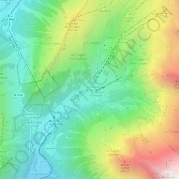
Nome: Mappa topografica Le Tour, altitudine, rilievo.
Altitudine media: 1’811 m
Altitudine minima: 1’250 m
Altitudine massima: 2’852 m
Fai una donazione
Equipaggiati per la tua prossima avventura:
In qualità di Affiliato Amazon, questo sito riceve una commissione sugli acquisti idonei, senza costi aggiuntivi per l’utente.
Altre mappe topografiche
Clicca su una mappa per visualizzarne la topografia, l'altitudine e il rilievo.
Réserve naturelle des Aiguilles rouges
France > Auvergne-Rhône-Alpes > Upper Savoy > Chamonix-Mont-Blanc
Altitudine media: 1’951 m
Glacier du Tour
France > Auvergne-Rhône-Alpes > Upper Savoy > Chamonix-Mont-Blanc
Altitudine media: 3’051 m
Mer de Glace
France > Auvergne-Rhône-Alpes > Upper Savoy > Chamonix-Mont-Blanc
The glacier lies above the Chamonix valley. The pressure within the ice is known to reach at least 30 atmospheres. The Mer de Glace can be considered as originating at an elevation of 2,100 metres (6,900 ft), just north of the Aiguille du Tacul, where it is formed by the confluence of the Glacier de Leschaux…
Altitudine media: 2’323 m
Mer de Glace
France > Auvergne-Rhône-Alpes > Upper Savoy > Chamonix-Mont-Blanc
The glacier lies above the Chamonix valley. The pressure within the ice is known to reach at least 30 atmospheres. The Mer de Glace can be considered as originating at an elevation of 2,100 metres (6,900 ft), just north of the Aiguille du Tacul [fr], where it is formed by the confluence of the Glacier de…
Altitudine media: 2’322 m
Fai una donazione
Equipaggiati per la tua prossima avventura:
In qualità di Affiliato Amazon, questo sito riceve una commissione sugli acquisti idonei, senza costi aggiuntivi per l’utente.
Glacier des Bossons
France > Auvergne-Rhône-Alpes > Upper Savoy > Chamonix-Mont-Blanc
In 1900 the snout of the glacier was still reaching down into the valley bottom at an altitude of 1,050 metres above sea level. By 1980 the snout only reached down to about 1,200 metres, and by 2008 it had melted backwards even further backwards, ended at around 1,400 metres, albeit still well below the…
Altitudine media: 3’138 m