
Mappa topografica Mabel Lake
Clicca sulla mappa per visualizzare l'altitudine.
A proposito di questa mappa
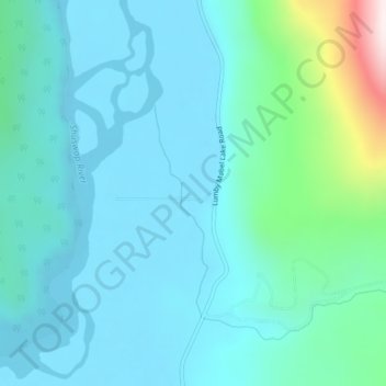
Nome: Mappa topografica Mabel Lake, altitudine, rilievo.
Altitudine media: 493 m
Altitudine minima: 394 m
Altitudine massima: 1’027 m
Altre mappe topografiche
Clicca su una mappa per visualizzarne la topografia, l'altitudine e il rilievo.
Vancouver
Canada > British Columbia > Metro Vancouver Regional District
Vancouver, British Columbia, is situated on the Burrard Peninsula, bordered by Burrard Inlet to the north and the Fraser River to the south. The city's topography is a blend of flat and hilly terrains, with elevations ranging from sea level to approximately 152 meters (500 feet) above sea level. The North…
Altitudine media: 34 m
Victoria
Canada > British Columbia > Capital Regional District
Victoria, British Columbia, is situated on the southern tip of Vancouver Island, Canada, and boasts a diverse and varied topography. The city is characterized by rolling hills, rugged coastal cliffs, and lush valleys, providing a striking contrast between mountainous terrain and flatland areas. To the north…
Altitudine media: 17 m
Vancouver Island
The rain shadow effect of the island's mountains, as well as the mountains of Washington's Olympic Peninsula, creates wide variation in precipitation. The west coast is considerably wetter than the east coast. Average annual precipitation ranges from 6,650 mm (262 in) at Hucuktlis Lake on the west coast…
Altitudine media: 411 m
Prince George
Canada > British Columbia > Regional District of Fraser-Fort George
The area has a humid continental climate (Köppen climate classification Dfb, Trewartha Dclo), but is close to (and once had) a subarctic climate (Dfc) as May and September averages are both close to the 10 °C (50 °F) threshold. Winters are milder than the latitude and elevation might suggest: the January…
Altitudine media: 685 m
Kelowna
Canada > British Columbia > Regional District of Central Okanagan
Kelowna is classified as a humid continental climate or an inland oceanic climate per the Köppen climate classification system due to its coldest month having an average temperature slightly above −3.0 °C (26.6 °F) and below 0 °C (32 °F), with dry, hot, sunny summers and cool, cloudy winters, and four…
Altitudine media: 704 m
Coquitlam
Canada > British Columbia > Metro Vancouver Regional District
Like much of Metro Vancouver, Coquitlam has an oceanic climate (Köppen climate type Cfb), experiencing mild temperatures and high precipitation; warm, dry summers and cool, wet winters. However, compared to most other cities in the area, precipitation is especially heavy in Coquitlam due to its proximity to…
Altitudine media: 190 m
Burnaby
Canada > British Columbia > Metro Vancouver Regional District
Burnaby occupies 98.6 square kilometres (38.1 sq mi) and is located at the geographic centre of the Metro Vancouver Regional District. The regional district's government is located in Burnaby's Metrotown area. Situated between the city of Vancouver on the west and Port Moody, Coquitlam, and New Westminster on…
Altitudine media: 59 m
Township of Langley
Canada > British Columbia > Metro Vancouver Regional District
Altitudine media: 47 m
Tsawwassen
Canada > British Columbia > Metro Vancouver Regional District > Delta
Altitudine media: 12 m
Chetwynd
Canada > British Columbia > Peace River Regional District
Carved out of an ancient floodplain, the small terrace upon which Chetwynd is situated lies in the northern foothills of the Rocky Mountains. Once used as a grazing spot by nomadic Aboriginals, the terrace was farmed by settlers until it was developed into a town. Two types of soil—namely, the Widmark and…
Altitudine media: 910 m
Saltspring Island
Canada > British Columbia > Capital Regional District > Salt Spring Island Electoral Area
Altitudine media: 72 m
Radium Hot Springs
Canada > British Columbia > Regional District of East Kootenay
Altitudine media: 912 m
Hernando Island
Canada > British Columbia > qathet Regional District > Area A (Malaspina/Toba)
Altitudine media: 23 m
Little Heffley Lake
Canada > British Columbia > Thompson-Nicola Regional District > Area P (Rivers and the Peaks)
Altitudine media: 1’035 m
Gabriola Island
Canada > British Columbia > Regional District of Nanaimo > Area B (DeCourcy/Gabriola/Mudge)
Gabriola is about 14 kilometres (9 mi) long by 4.2 kilometres (2.6 mi) wide on average with a land area of 57.6 square kilometres (22.2 sq mi). The topography varies from flat sandy beaches at sea level to forested hills rising to 160 metres (525 ft) on Stoney Ridge in the centre of the island.
Altitudine media: 26 m
Okanagan Lake
Canada > British Columbia > Regional District of Central Okanagan > Kelowna
Altitudine media: 1’194 m
Kootenay Lake
Canada > British Columbia > Regional District of Central Kootenay
Altitudine media: 1’609 m
Summerland
Canada > British Columbia > Regional District of Okanagan-Similkameen
Altitudine media: 696 m
Keremeos
Canada > British Columbia > Regional District of Okanagan-Similkameen
Altitudine media: 441 m
Quadra Island
Canada > British Columbia > Strathcona Regional District > Area B (Discovery Islands/Mainland Inlets)
Altitudine media: 128 m
Shuswap Lake
Canada > British Columbia > Columbia-Shuswap Regional District > Area F (Scotch Creek/Seymour Arm)
Altitudine media: 1’064 m
Savary Island
Canada > British Columbia > qathet Regional District > Area A (Malaspina/Toba)
Altitudine media: 3 m
Vargas Island
Canada > British Columbia > Alberni-Clayoquot Regional District > Area C (Long Beach)
Altitudine media: 11 m
West End
Canada > British Columbia > Metro Vancouver Regional District > Vancouver
Altitudine media: 15 m
Titetown Lake
Canada > British Columbia > Cariboo Regional District > Area I (West Fraser/Nazko)
Altitudine media: 864 m
Mission
Canada > British Columbia > Fraser Valley Regional District
The western part of the district, the Stave Valley, is largely rural and forested but its watercourse is home to what was the largest hydroelectric project in British Columbia until the Bridge River Power Project opened in 1961. It was built by the British Columbia Electric Railway (BCER) to provide power to…
Altitudine media: 345 m
Pitt Lake
Canada > British Columbia > Metro Vancouver Regional District > Electoral Area A
Altitudine media: 659 m
Bute Inlet
Canada > British Columbia > Strathcona Regional District > Area B (Discovery Islands/Mainland Inlets)
The Bute Inlet route was later considered for the mainline of the Canadian Pacific Railway (CPR), which would have seen extensive blasting down the west shore of the inlet and a series of bridges to reach Vancouver Island near Campbell River via Seymour Narrows. This route was passed over in favour of the…
Altitudine media: 921 m
Arbutus-Ridge
Canada > British Columbia > Metro Vancouver Regional District > Vancouver
Altitudine media: 60 m
Vedder River
Canada > British Columbia > Fraser Valley Regional District > Chilliwack
Altitudine media: 110 m
Bonaparte Lake
Canada > British Columbia > Thompson-Nicola Regional District > Area O (Lower North Thompson)
Altitudine media: 1’383 m
Penticton
Canada > British Columbia > Regional District of Okanagan-Similkameen
Penticton is located at the geographical coordinates of 49°29′28″N 119°35′19″W / 49.49111°N 119.58861°W / 49.49111; -119.58861 (Penticton) and covers an area of 42.10 km2 (16.25 sq mi), with a maximum north–south distance of 7 km (4.3 mi) wide between the Okanagan Lake to the north…
Altitudine media: 702 m
Revelstoke
Canada > British Columbia > Columbia-Shuswap Regional District
A small ski resort featuring a single short lift has operated on Mount MacKenzie since the 1960s, and snowcat skiing was offered for higher altitudes. A strong movement pushed to expand the entire mountain into a single resort, and construction started in the early 2000s (decade).
Altitudine media: 982 m
Texada Island
Canada > British Columbia > qathet Regional District > Area D (Texada Island)
Altitudine media: 83 m
Lasqueti Island
Canada > British Columbia > qathet Regional District > Area E (Lasqueti Island)
Altitudine media: 52 m
Gambier Island
Canada > British Columbia > Sunshine Coast Regional District > Area F (West Howe Sound)
Altitudine media: 130 m
Mara Lake
Canada > British Columbia > Columbia-Shuswap Regional District > Area E (Eagle River Valley) > Swansea Point
The lake is 35.3 kilometres (21.9 mi) long. The surface area is about 1,943 hectares (4,800 acres) and elevation is 338 metres (1,109 ft) above sea level. The mean and maximum depth is 18 metres (59 ft).
Altitudine media: 826 m
Monashee Provincial Park
Canada > British Columbia > Regional District of North Okanagan > Area E (Cherryville/East Creighton)
Altitudine media: 1’677 m
Dominic Lake
Canada > British Columbia > Thompson-Nicola Regional District > Area J (Copper Desert Country)
Altitudine media: 1’583 m
Saturna Island
Canada > British Columbia > Capital Regional District > Southern Gulf Islands Electoral Area
Altitudine media: 34 m
Stave Lake
Canada > British Columbia > Area F (McConnell Creek/Hatzic Prairie)
Altitudine media: 576 m
Comox Glacier
Canada > British Columbia > Alberni-Clayoquot Regional District > Area D (Sproat Lake)
Altitudine media: 1’593 m
Aldergrove Regional Park
Canada > British Columbia > Metro Vancouver Regional District > Township of Langley
Altitudine media: 64 m
Brentwood
Canada > British Columbia > Metro Vancouver Regional District > Burnaby
Altitudine media: 69 m
Oyama Lake
Canada > British Columbia > Regional District of Central Okanagan > East Central Okanagan Electoral Area
Altitudine media: 1’387 m
Skaha Lake
Canada > British Columbia > Regional District of Okanagan-Similkameen > Area I (Skaha West/Kaleden/Apex) > Kaleden
Altitudine media: 701 m
Beaver Lake
Canada > British Columbia > Peace River Regional District > Area E (Moberly Lake/Sukunka Valley)
Altitudine media: 692 m
Area B (Lake Koocanusa)
Canada > British Columbia > Regional District of East Kootenay
Altitudine media: 1’390 m
Echo Lake Provincial Park
Canada > British Columbia > Regional District of North Okanagan > Area D (Trinity/West Creighton)
Altitudine media: 1’119 m
Gwaii Haanas National Park Reserve and Haida Heritage Site
Canada > British Columbia > North Coast Regional District
Altitudine media: 41 m